Orthorectification
Orthority is a command line toolkit and library for orthorectifying remotely sensed imagery. It was originally developed as a research tool for processing NGI aerial imagery. Since then it has been expanded to support a range of imagery and camera models, and to provide orthorectification related methods like pan-sharpening. Together with Homonim, it provides an open source toolchain for converting remotely sensed images into “science ready” surface reflectance data.
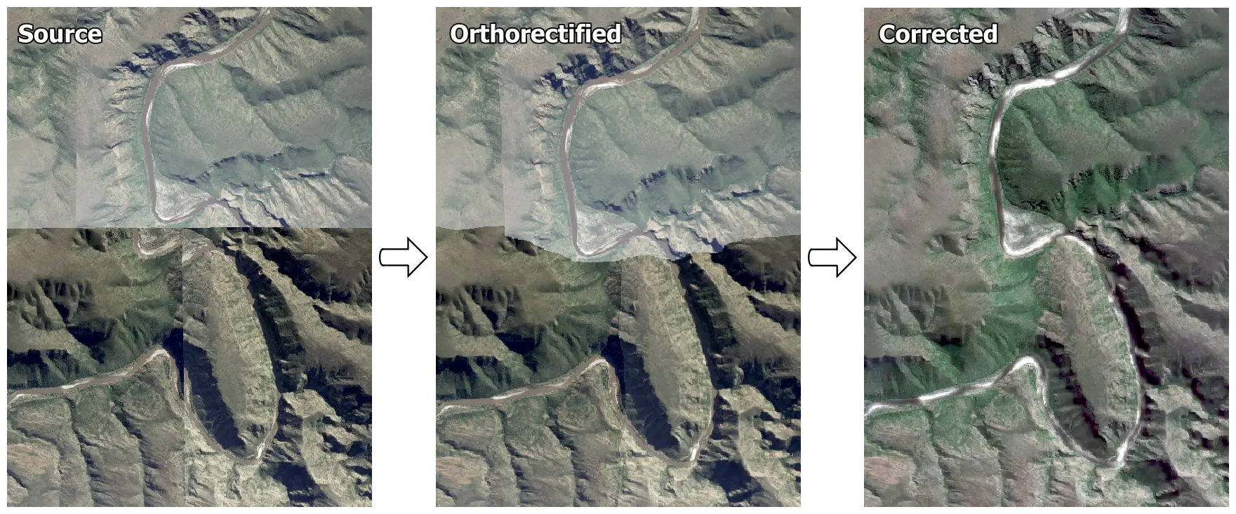
A mosaic of four NGI images (Source) that has been orthorectified with Orthority (Orthorectified), then corrected to surface reflectance with Homonim (Corrected).