Farm-scale aboveground carbon mapping in thicket
As part of the GEF-5 SLM (sustainable land management) project, this work developed an aboveground carbon (AGC) mapping approach for thicket in a ±3000 ha study area in the Baviaanskloof. Field methods were used to gather AGC ground truth for number of plots:
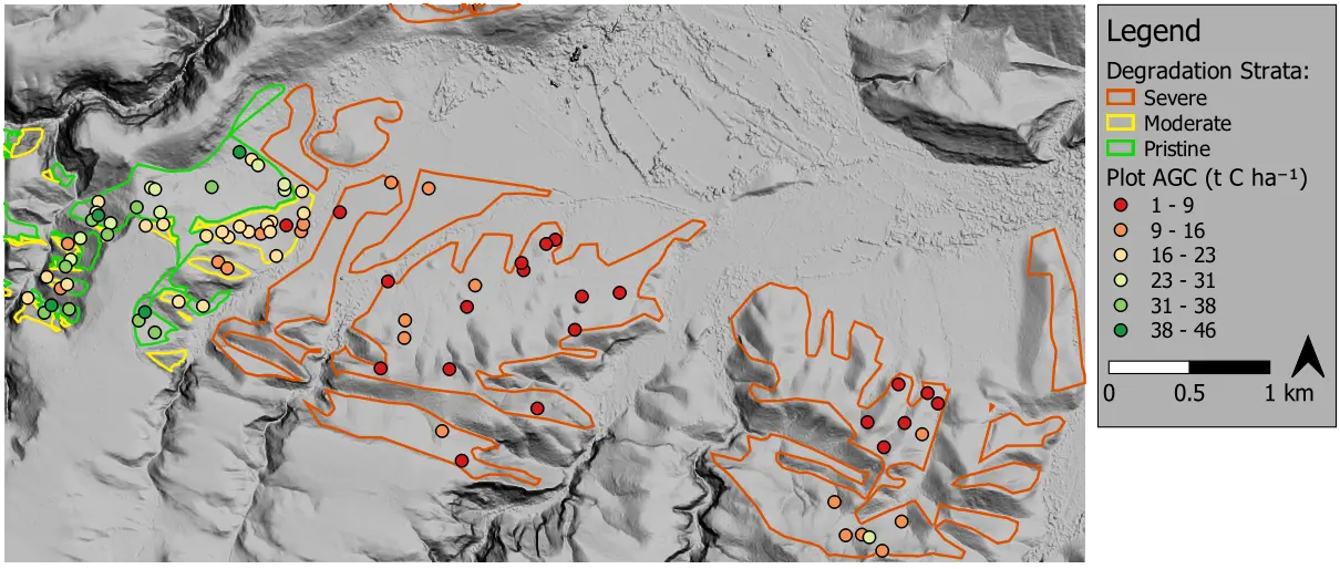
Various approaches for modelling AGC were evaluated using the ground truth. Straightforward linear regression models using high resolution multispectral satellite (WorldView-3) imagery performed well. The code repository and related paper contain more details on the data, method and performance.